
Map of Grenada
BOOK ACCOMMODATION IN ANY PART OF GRENADA AT GREAT PRICES
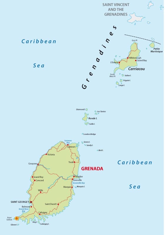
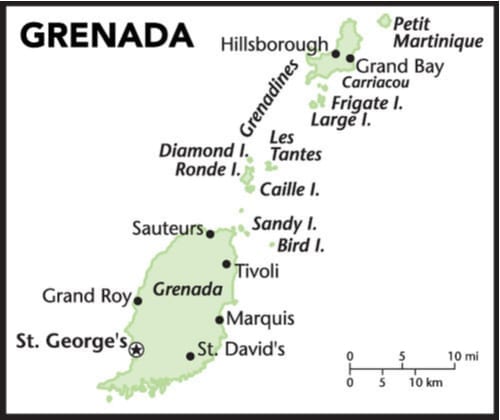
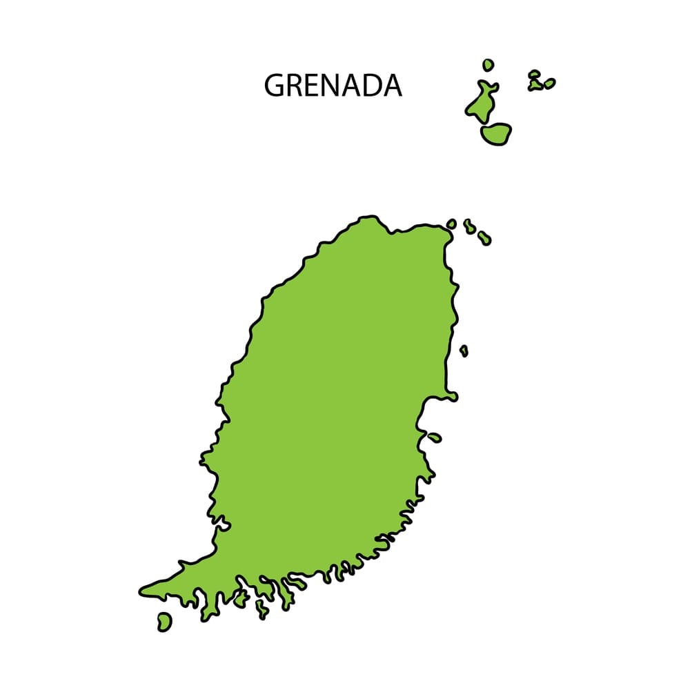
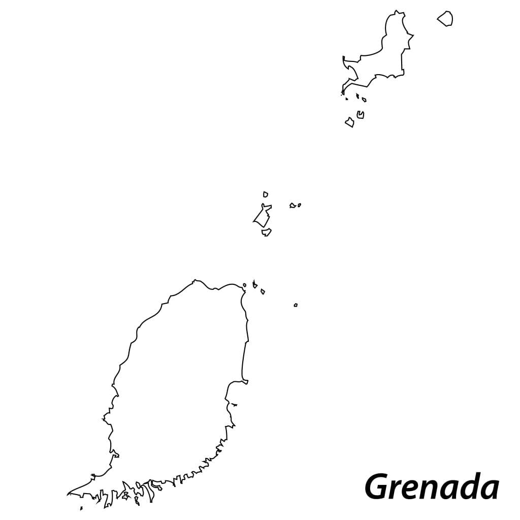
Where is Grenada located
Let’s get some insights about the beautiful island country Grenada, also known as the Island of Spice. Where Grenada is located is a tricky question because the Caribbean Sea has more than 7000 islands and sometimes it becomes very difficult to pinpoint the exact location of one. Moving from upper hierarchy to lower grading, Grenada on the world map is located in North America in the West Indies in the Lesser Antilles region of Eastern Caribbean Sea within the Windward Islands group. The Group comprises many small island formations with three major islands; Grenada, Carriacou and Petit Martinique. Of these, Grenada is the largest. Grenada is an independent nation located close to Trinidad and Tobago with Venezuela in the north, and Saint Vincent and the Grenadines in the south.
Grenada Tourism
People visiting Grenada praise it highly for multiple entertainment opportunities, close to nature experiences, beaches, watersports, enchanting cultural events, mouth-watering spices, and many more delightful activities. These islands are usually not so crowded so you can visit here anytime during the year. The reefs, lush palm trees, relaxing sun rays, and white sand beaches are more than enough to capture one’s wanderlust. But on top of that, the country also offers natural parks and reserved rain forests. One of the striking tourists hit is Grenada Underwater Sculpture Park that offers a combo of swimming experience and an underwater museum.
The capital city, St. George, well-known for its beautiful buildings, sailing boats, hillside volcanoes and harbour is the most preferred location for travellers. However, there is a lot more to explore within Grenada besides the capital. The islands, the waterfalls, the hiking, and the parties require at least a full week tour to enjoy fully. People of Grenada are very lively and loving. Held in August, Spicemas Grenada Carnival is the biggest event that provides a close opportunity to observe the culture with all its festive outlook. Some of the important sites to visit here include Grand Anse Beach, Fort George, Fort Frederick, House of Chocolate, Grenada National Museum, Carenage, and Belmont Estate.
Grenada Population
On geographic mapping, the land is about 340 km square in size. The current population in mid-2020 as recorded by UN data is 112,523 people. Grenada has been a household for many races. It was home to native nations known as Arawak and Carbis until the Europeans set their foot here with Columbian discovery of this island in 1498. Since then, the island has seen many ups and downs. Rigorous invasions by different nations like British, French, Americans, and a forced transport of African slaves have rendered the growth of a mixed population. The present population have traits of Indian, European, African, and American races.
It has 195th position among the countries and dependencies according to the United Nations Population Division estimates. The yearly increase in the number of people has been marked from 0.3% to 0.4% within this last decade. With a population density of about 331 per Kilometer square, the country holds 35.5% of its inhabitants in urban areas only. According to a recent dataset, the median age of Grenadians is 32 years, that means half of the people are below and others are above this average age.
Grenada Facts
- The topography of Grenada is originally volcanic with a mountain line stretching between north and south. A famous elevation among these hills is 840 meters known as Mount St. Catherine. The foothills are covered with steep forests and deep valleys all over.
- The nutmeg trees were brought here in 1843. Since then, its massive reproduction and trade have rendered the plant win a title as ‘Grenada’s gold’. Maps from 1850 marked the land as “Spice Island of the Caribbean” as its nutmeg production helped to restore a crop disaster that hit the Dutch Indonesian trade.
- The mountainous coastline here favours wet tropical weather with mainly two seasons, a rainy season from June to December and a dry season extending over the first half of the year. The rainfall varies with peaks from 1500 mm to 3800 mm. Officially a hurricane season is also marked from June to November. The average temperature is about 28 degrees Celsius.
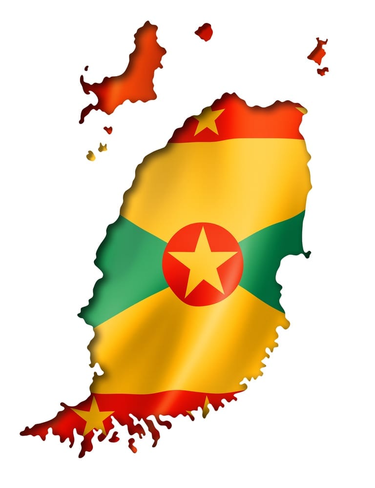
Grenada Flag Meaning
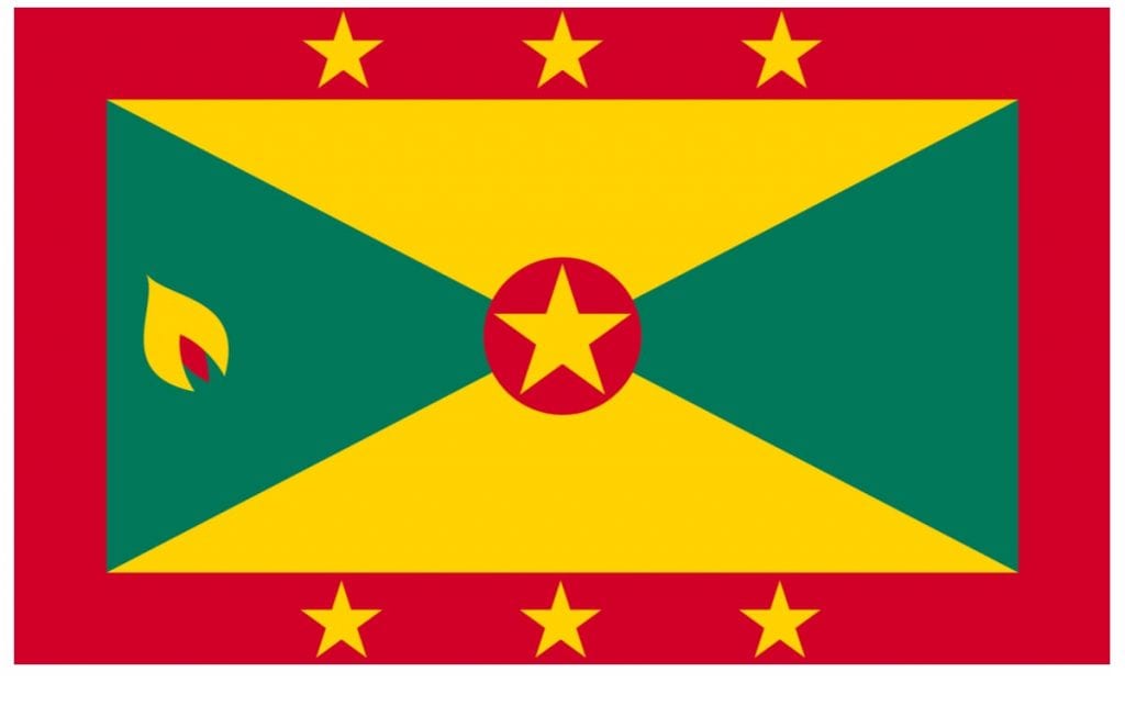
The present Grenada flag dates to the country’s independence from the United Kingdom in 1974. Before that, this Caribbean island had three flags in successive periods being a colony and an associated state to the British empire. In 1974, as it gained its sole independence and became a fully self-governing territory, a new flag was created that continues to date. Anthony C. George, an artist from Soubise in Saint Andrew Parish designed it, and the flag was waved for the first time at midnight, February 6/7, 1974.
The flag has a unique pattern with a quite meaningful colour scheme. It has 3 to 5 width to length ratio with thick red borders. The central portion has a gold star inside the red disc and around that are 4 triangles. Two triangles are green and two are golden. The triangles are crossed in a scheme of green-golden-green-golden each intersecting with other diagonally. A clove of nutmeg is designed within a green triangle at the flag’s hoist portion. Apart from the central one, there are six more gold stars; three on the upper border and three on the lower border. The overall colour scheme follows three colours red, green, and golden.
Grenada Flag Colors
These colours add a lot of meaning and value to Grenada and its people. Red is the colour of sacrifice, bravery, freedom fights, and valour. It depicts the struggle and respect for independence. Green signifies the plantation and lush green forests. The country is very rich in its agricultural industry. In other words, green is a symbol of its economy. Golden refers to the wisdom and kindness of its people. It also relates to the warm sun that shines over its white sands. The six border stars depict six parishes; Saint Mark, Saint John, Saint George, Saint Patrick, Saint Andrew, and Saint David. The central star is for the capital city of Saint George. Finally, the nutmeg symbolizes the country’s largest crop production.
BOOK ACCOMMODATION IN ANY PART OF GRENADA AT GREAT PRICES