Map of Kiribati | Kiribati Flag Facts | Places to visit in Kiribati
Who doesn’t love a good vacation? The aftermath of the pandemic has greatly added a need to just go to another country, have a great time and unwind. Countries in Oceania are absolutely perfect for a nice relaxing vacation that won’t break your bank and you’ll experience luxury like never before. Kiribati is one of the many countries in Oceania that offers once-in-a-lifetime experiences that you can’t find anywhere else! Let’s take a virtual trip through this article to the beautiful island country.
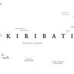
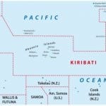
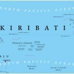
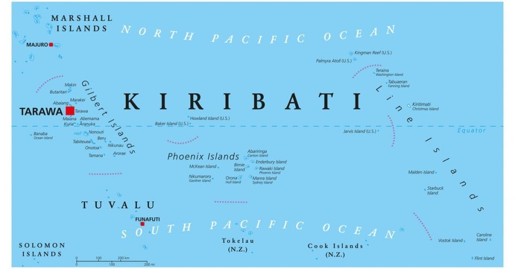
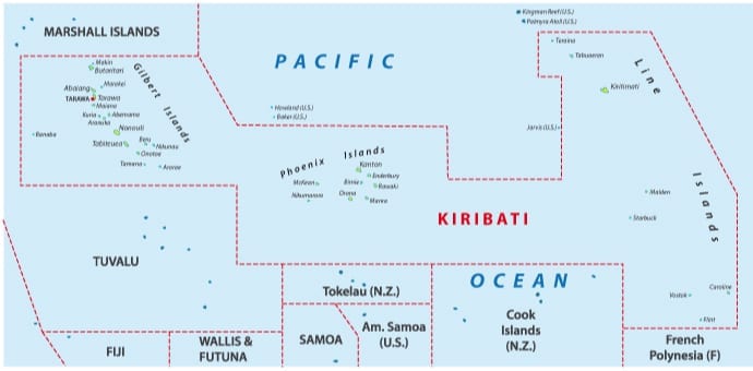
Map of Kiribati

BOOK HOTEL IN ANY PART OF KIRIBATI AT GREAT PRICES
Is Kiribati in Micronesia or Australia?
Micronesia is a subregion of Oceania and has several islands towards the west of the Pacific Ocean. The countries or islands in Micronesia share the same cultural history with each other but also with the other island regions i.e. Polynesia, Philippines and Melanesia. Kiribati is situated between Australia and Hawaii around both Micronesian and Polynesian regions in the South Pacific.
Is Kiribati a US territory?
Kiribati was previously colonized by the United Kingdom. After the country’s independence, Kiribati signed a treaty of friendship with the United States in 1979. The two countries established full diplomatic relations in 1980. Kiribati and the US work together on a lot of issues targeting several areas from education, climate change to regional security, fisheries protection and food & water security.
How many islands are there in Kiribati?
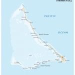
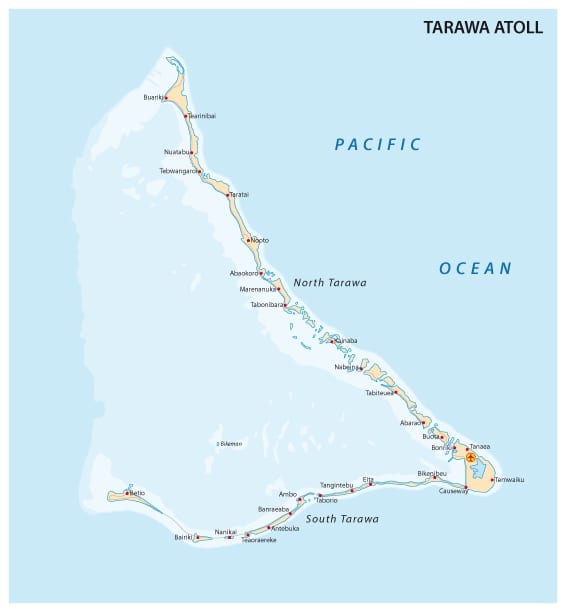
Kiribati has a total of 33 coral islands that are divided into three island groups namely the Gilbert Islands, the Phoenix Islands and the Line Islands. All of these islands are atolls i.e. it is a ring-shaped island with central lagoons. Kiribati houses the biggest atoll of the world called Kiritimati Atoll present in the Line Islands that covers about half of the country’s total area. This atoll was used in the 1960s by the US and the UK for nuclear weapon testing but now the atoll contains several fish farms, coconut plantations and numerous satellite telemetry stations. Most of the population lives on Tarawa atoll.
Kiribati Flag Facts
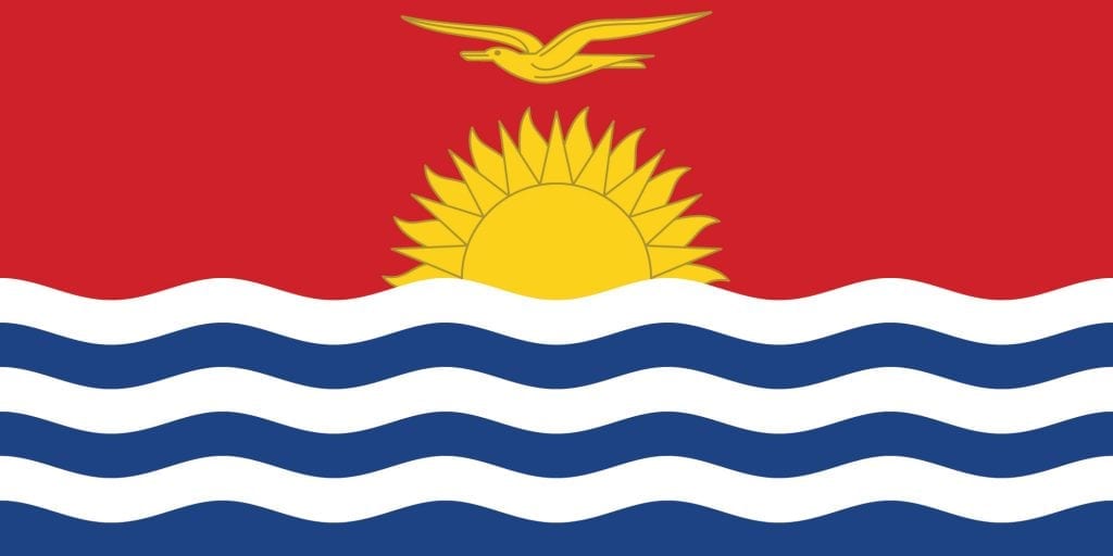
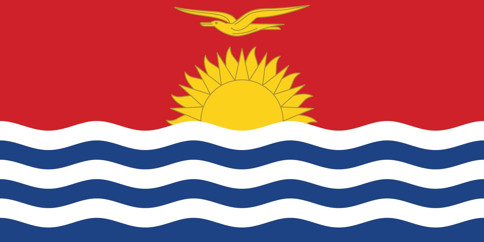
During British rule, several countries of Oceania were colonized. The Gilbert Islands was one of them which were inhabited by the Micronesian population. After their independence in 1979, a competition for the design of the flag was held. A design inspired by the colonial coat of arms was submitted to the College of Arms. The College of Arms further modified the design but the locals preferred the original design. The new flag was officially adopted on July 12, 1979, in Kiribati’s capital, Tarawa
Colors and Meaning of Kiribati Flag
Kiribati’s flag is rather unique as compared to the usual straight sectioning of flags with blocks of color. The flag uses a total of 4 colors: red, yellow, navy blue and white. The background or the top color is red with a yellow bird flying over the rising sun, below the sun are three horizontal wavy stripes of blue and similar three stripes of white. These three stripes represent the three regions that Kiribati is divided into; Gilbert Islands, Line Islands and the Phoenix Islands. The frigatebird represents dance patterns, freedom and their command over the sea whereas the sun is meant to represent Kiribati’s position on the Equator.
Population of Kiribati
The population of Kiribati is 115,847 with half of the population residing in the country’s capital. The people here are mostly Micronesians with most of the population being Roman Catholic where the rest is Kiribati Protestant. The people are culturally and ethnically homogenous and they share genetic history. People of Kiribati call themselves I-Kiribati and they pride themselves in their unique and rich culture which greatly differs from that of the west.
Language of Kiribati
There are two official languages of Kiribati: English and Gilbertese. English, however, is not that commonly used outside Tarawa. It is often mixed with Gilbertese. The older people speak an older version of Gilbertese with words that are not commonly in use anymore.
Interesting Facts about Kiribati
Kiribati’s location and the number of atolls that it is composed of makes it really unique than any other country. Kiribati is one of the first countries to celebrate the New Year with being the furthest ahead of Greenwich time with GMT+14. Here are some of the really interesting facts about Kiribati that are not commonly known:
- There used to be two more islets in Kiribati that disappeared in 1999 due to global warming and a drastic rise in the sea levels.
- Kiribati has a relatively smaller land area of just 811 square km but it is so widely spread that it makes up the size comparable to that of India.
- It is the only country in the world that falls into all the four hemispheres; Northern, Southern, Eastern and Western.
Places to Visit and Experience in Kiribati
Kiribati is surprisingly not a famous country which makes it perfect for amazing experiences without waiting lines and huge crowds. Here are some of the things that you can do and enjoy in Kiribati
- Christmas Island – With being home to unique floral and fauna, Christmas Island is also home to beautiful birds making it perfect for people who love bird watching.
- Outer Gilbert Islands – Want to enjoy the beach with just you and the sound of the waves? This is the place to go with not just offering the serene nature but also you get to experience the authentic rural culture of Kiribati.
- World War II Remains – Tarawa was occupied by the Japanese during World War II and Oceania experienced several bloody battles during those times which left a lot of wreckage that is now treated as a tourist attraction.
- Giant’s Footprints – There is a famous local legend about several depressions on the ground that look like footprints and you can distinguish heels from the toe.
BOOK HOTEL IN ANY PART OF KIRIBATI AT GREAT PRICES

